Aletsch Glacier, Switzerland

Location: Jungfrau Region, Switzerland
Date: August 2012
Duration: 2 days
Distance: 21 Kilometers
Transportation: Scarpa Triolet Pro GTX
Viewed: 19847 times
Date: August 2012
Duration: 2 days
Distance: 21 Kilometers
Transportation: Scarpa Triolet Pro GTX
Viewed: 19847 times
There are some adventures like hiking down Grand Canyon or diving with sharks in Polynesia, for which emotions can only be conveyed by experiencing them.
The Altesch Glacier is certainly one of those. No word can manage to translate the experience, what it feels like to witness this unique landscape and spend the night at the Konkordia Hut at 2850 meters of altitude.
For a total glacier virgin like I was, this trip was the perfect way to get a first impression of what hiking on a glacier was.
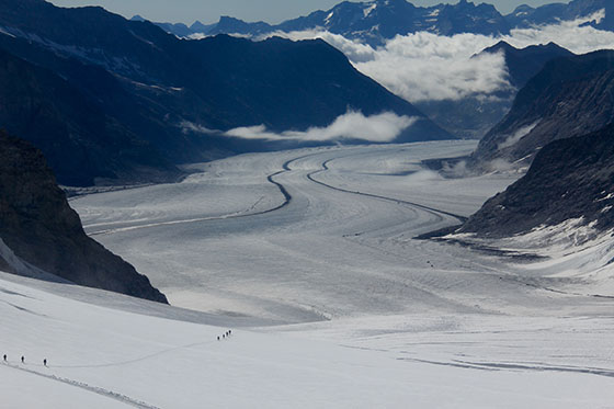
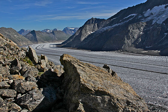
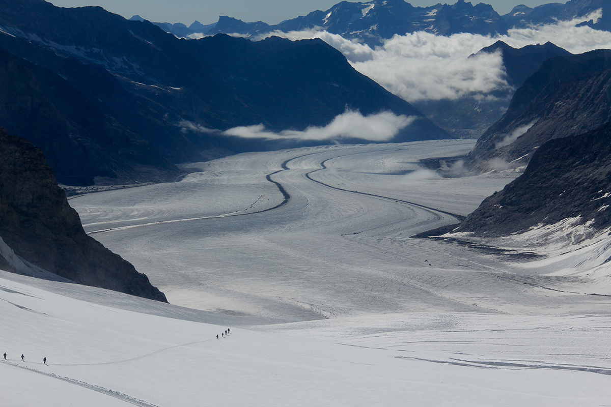
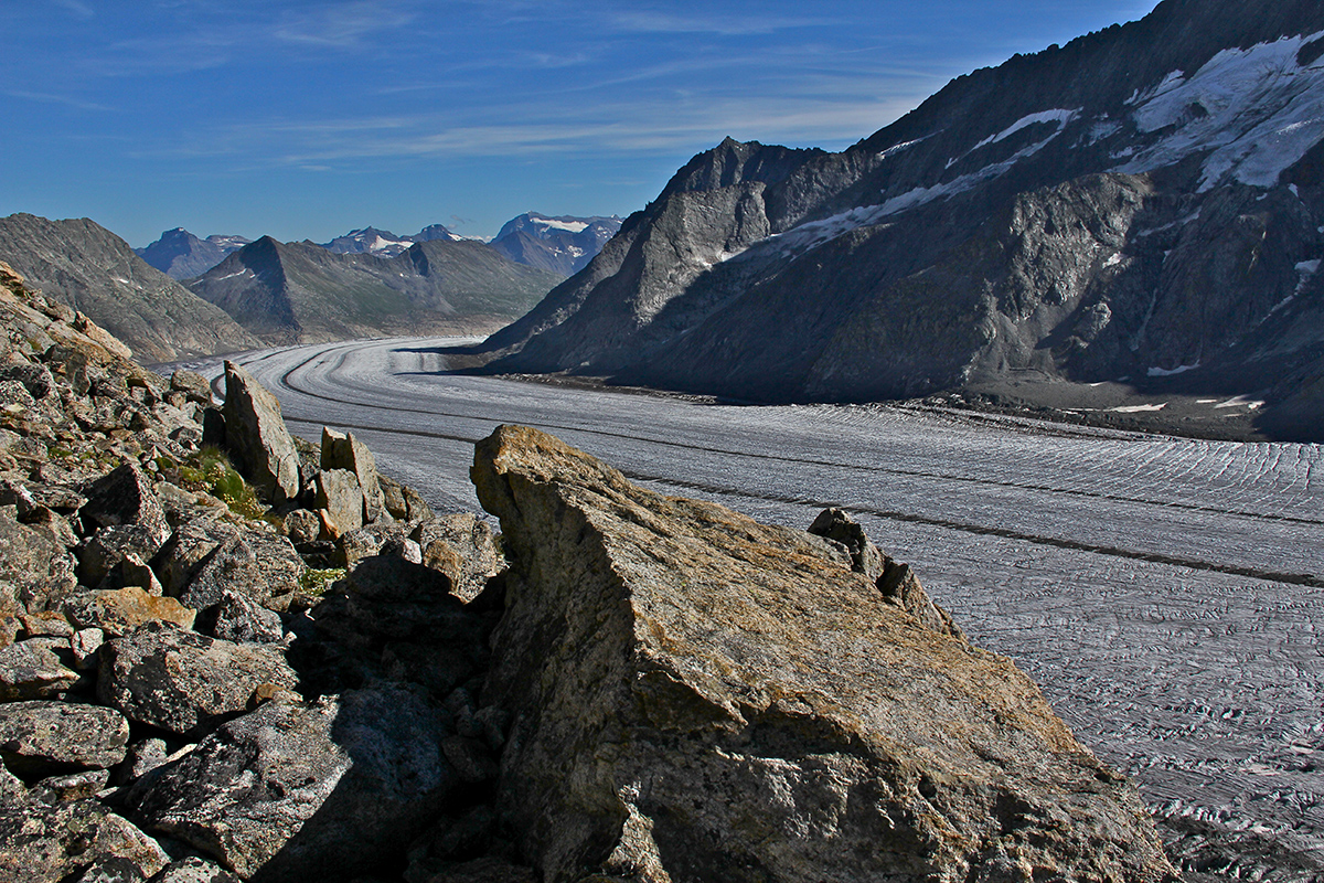
The Aletsch Glacier is the largest glacier in the Alps, with a length of 23 kilometers (14 miles).
The typical trademark of this glacier is the set of two medial moraines, which are the result of three smaller glaciers converging at the Konkordiaplatz, where the ice sheet is said to be 900 meters thick.
The three glaciers are the Aletschfirn, the Jungfraufirn and the Ewigschneefäld.
Another fourth glacier converges at the Konkordiaplatz, the Grüneggfirn, but being a much smaller glacier, its flow is dwarfed and obliterated but the sheer flow of ice coming from the Ewigschneefäld.
Grindelwald Sports in Grindelwald is the place to go to organize such a trip. The very friendly and welcoming team was extremely helpful in providing prompt and accurate information and advice based on personal experience and wishes.
They have many options in the Jungfrau region, ranging from regular trips like the Aletsch Glacier hike planned several times a month, to booking your own mountain guide and go anywhere you wish for as long as you wish, any time of year.
I recommend contacting them in case such adventure is on your mind
Grindelwald SPORTS AG
Dorfstrasse 110
3818 Grindelwald
Tel +41 (0)33 854 12 80
Fax +41 (0)33 854 12 95
Email: info@grindelwaldsports.ch
www.grindelwaldsports.ch
www.facebook.com/grindelwaldsports
At the time, the price was 325CHF per person for the hike only. They also have a price including the train ticket from Interlaken to the Jungfraujog, and back from Fiescheralp to Interlaken.
The price includes the hike with a mountain guide, the crampons & harness, the food at the Konkordia Hut for the evening dinner and breakfast, and of course the night at the hut.
Anyone can sign up and join an existing group of hikers.
In case one wants to hire a private mountain guide and hike or climb to a different place, or do this same hike but at some other time not joining an existing group, this is of course doable year round at a higher price.
The idea is that a mountain guide charges a fee per day, and the cost is divided by the number of people in the group.
The trip can be canceled at the last minute due to bad weather. Some might travel from far away and would have to factor in this possibility.
That's what actually happened the weekend before. The trip got then rescheduled during the week on the following Tuesday and Wednesday.
The week option seems to have been better because that night we were 70 people staying over at the Konkordia Hut. Hikers and mountaineers converge there because of the many possible hike options around the Konkordia.
Over the following weekend, the hut was supposed to be packed with 140 people, running at its maximum capacity.
We met with the mountain guide and the rest of the group at the Jungfraujog around 10:30 in the morning.
Our guide was Werner Fischer. He had 47 years of experience and has been a mountain guide like his father and grand father before him.
After a short briefing outside the Jungfroujog on the glacier, the seven of us including the guide set out for Konkordia Hut where we would spend the first night.


one of the three main Aletsch Glacier's affluents")


and the Alteschhorn at 4193 meters of altitude")
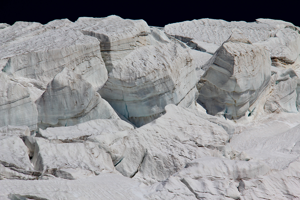
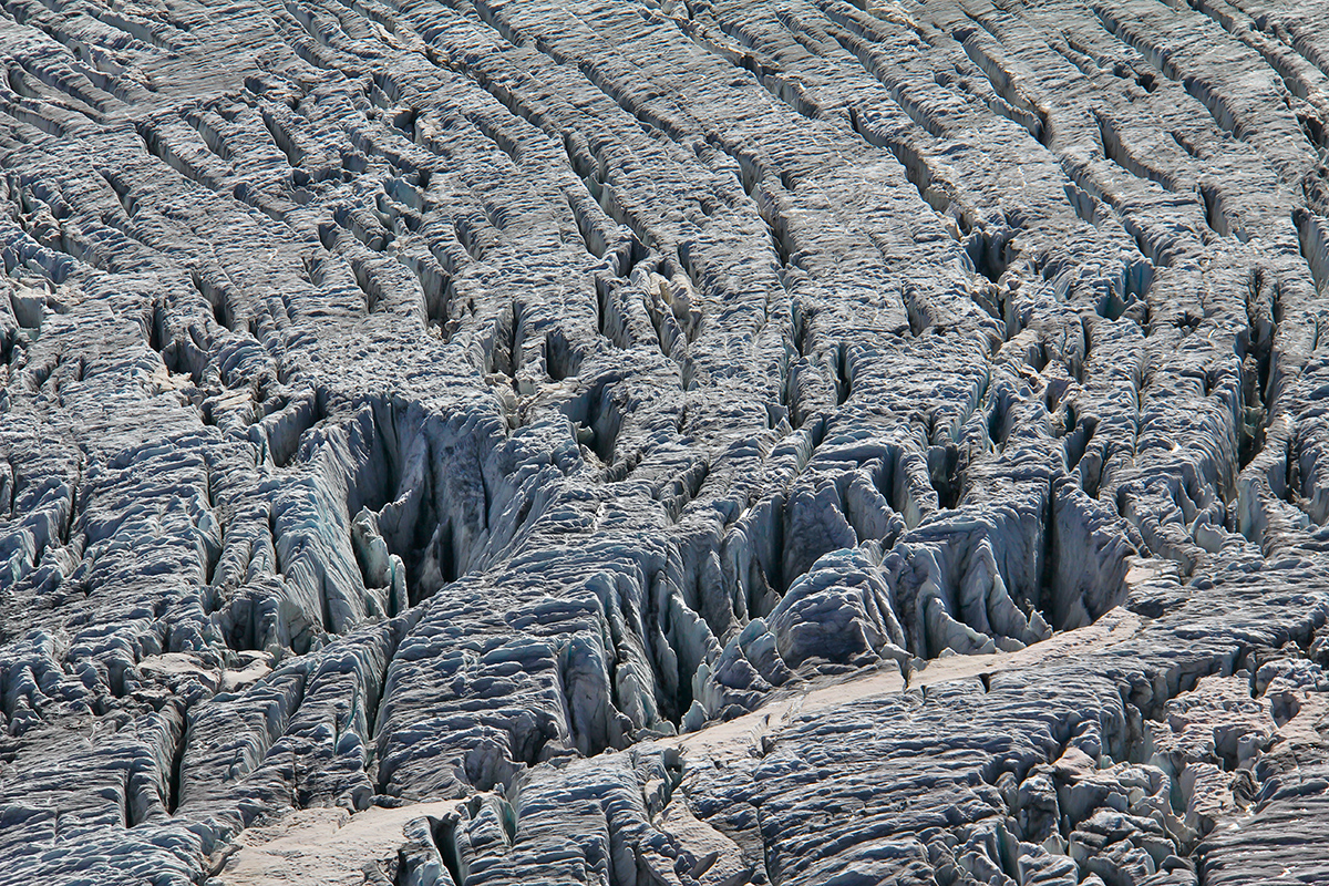
Viewed from afar, the dark medial moraine looks like a combination of sand and loose gravel. Up close, those gravels are actually massive blocks of rocks as it can be seen on the picture below.


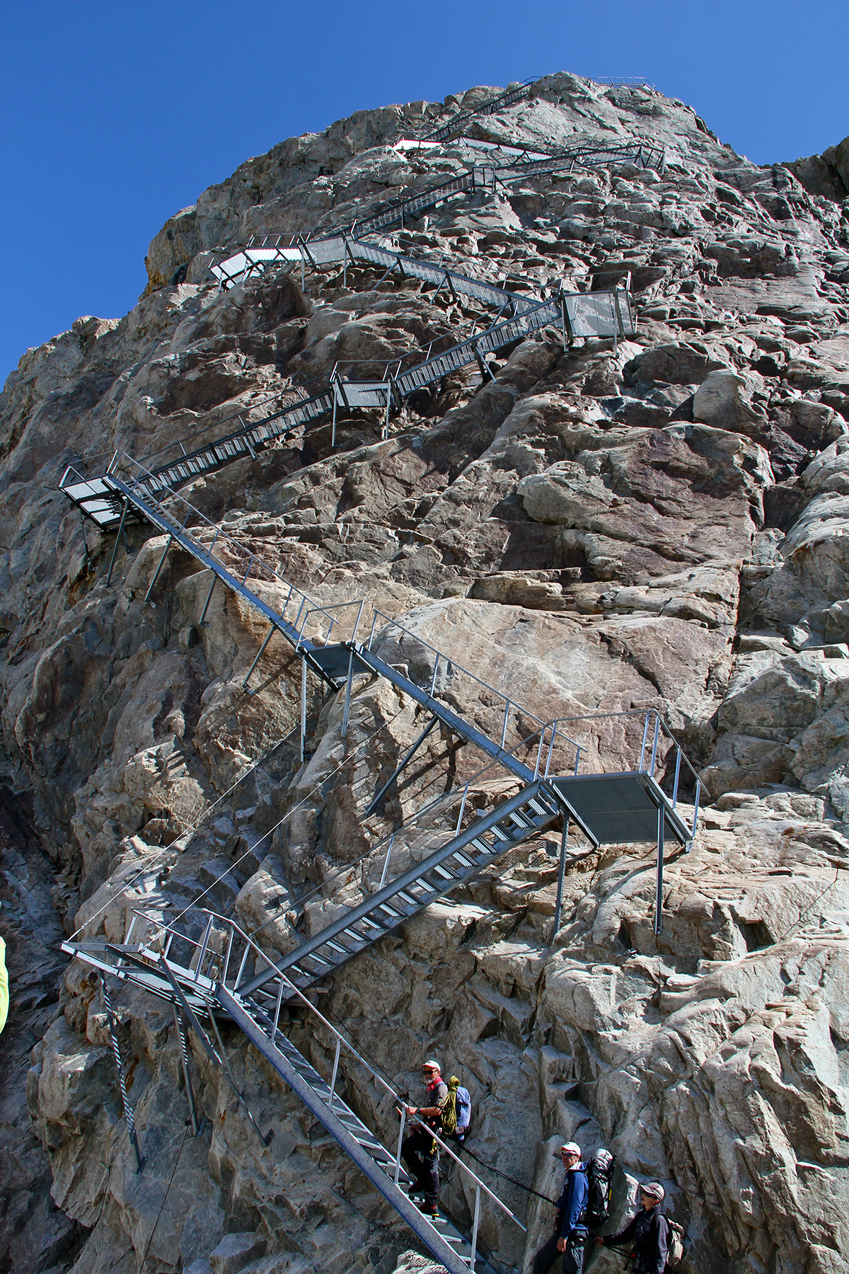
On the other side of the glacier we leave the sedimentary rocks found at the Jungfrau and reach a different geological layer made of granite, more solid, which creates a different landscape as it erodes differently and breaks down into blocks of different shapes. The glacier has lost 100 meters in thickness since 1877 when the original hut was built. There is a steel staircase to climb up the 150 meters separating the hut from the glacier.
Since 1960 the glacier has shrunk so much that the steel staircase has been expanded to reach the moraine.
")

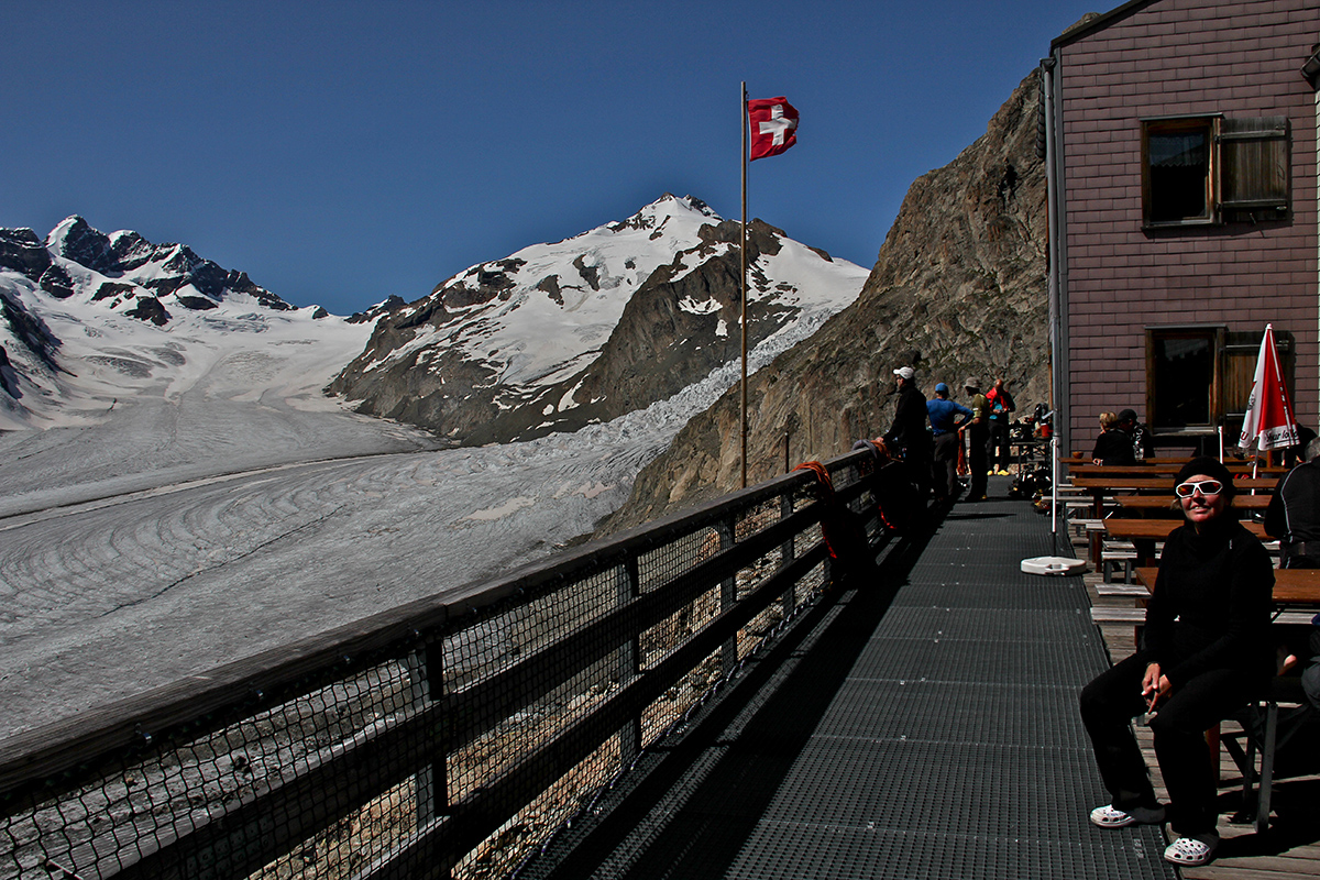
We arrived at the Konkordia Hut around 14:00, and had the whole afternoon to sit down and enjoy the breathtaking view, while enjoying a few drinks from the bar.


Later in the day, after a hearty meal, we could hear conversations such as:
- What time is breakfast tomorrow morning?
- Anytime starting from 3:30
- Oh good, perfect!
For a first timer like I was, I found the situation amuzing.
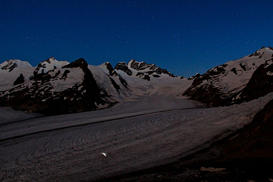
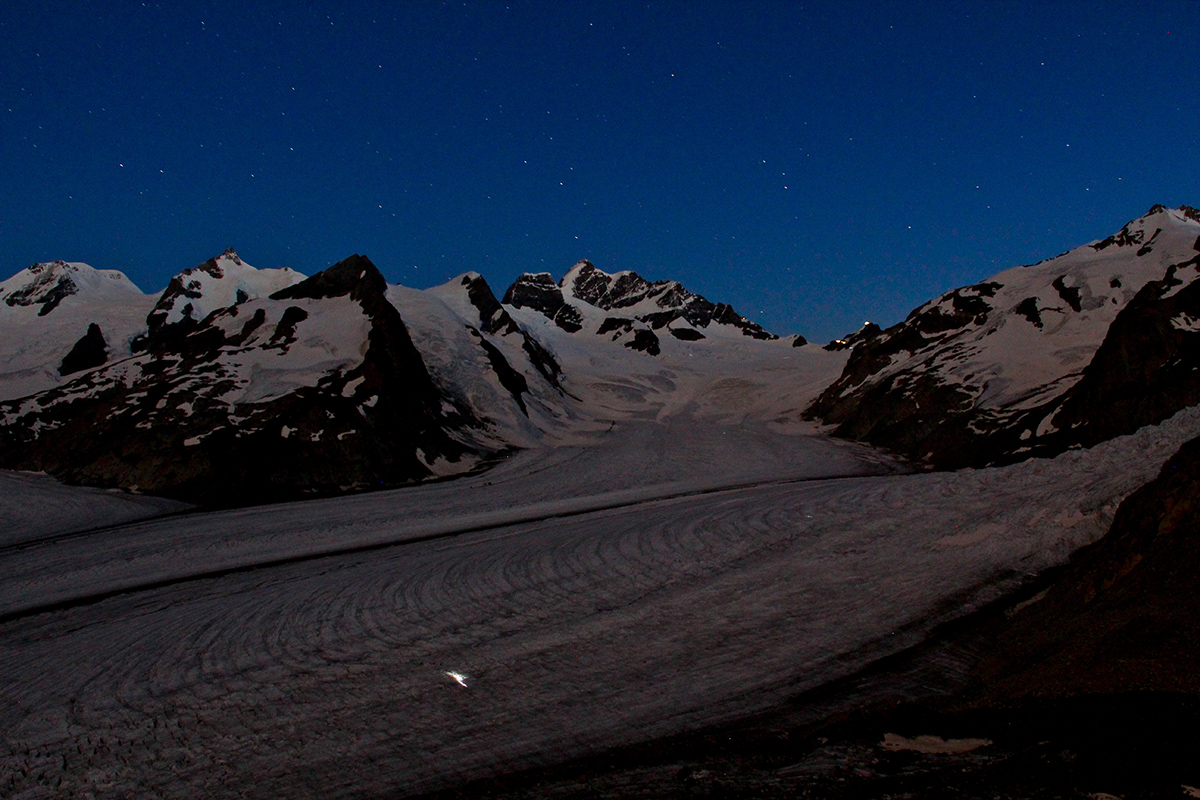
The next morning we were supposed to wake up at 4:30, have breakfast a 5:00 and be gone by 5:30. For some reason I woke up naturally at 4:15 and ran outside to enjoy the very first glimmer of dawn, only to realize that some had woken up way earlier and were already crossing the Konkordiaplatz with their headlights on.
Others can be seen in the distance on their way up to the Jungfrau. The partial moon helped photographing the scene.

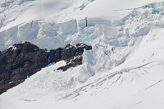
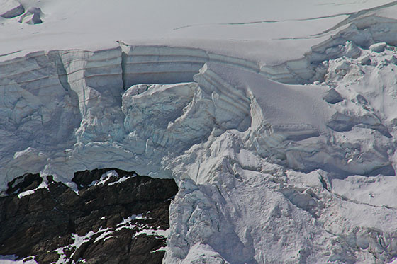
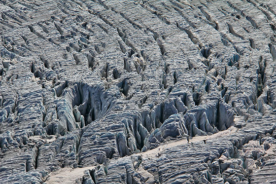
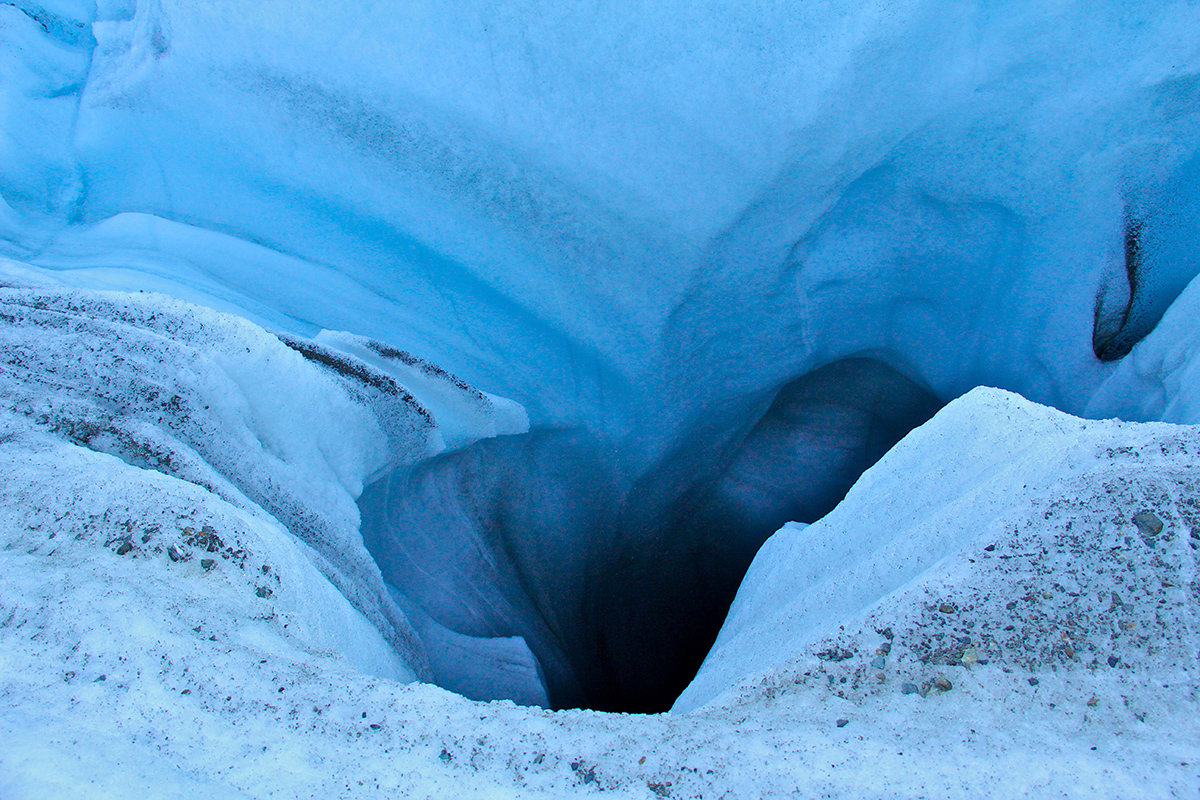
The water streams at the surface of the glacier usually end up in a large hole like the one below, which likely drops to the bottom of the glacier bed. Impossible to lean over and see the bottom of this massive hole without getting into some serious trouble.


")


After a stop at the Gletscherstube Hut for a drink, and after crossing the tunnel, the Gletscherstube, I thought the show was over, but to my greatest surprise, on the other side we discovered a beautiful valley and in the distance another magnificent glacier, the Fiescher Glacier (Fieschergletscher).
")
We then only had to hike down to Fiesheralp, pause for lunch and catch a gondola down to Fiesch in the valley where we could catch a train back to where we came from.
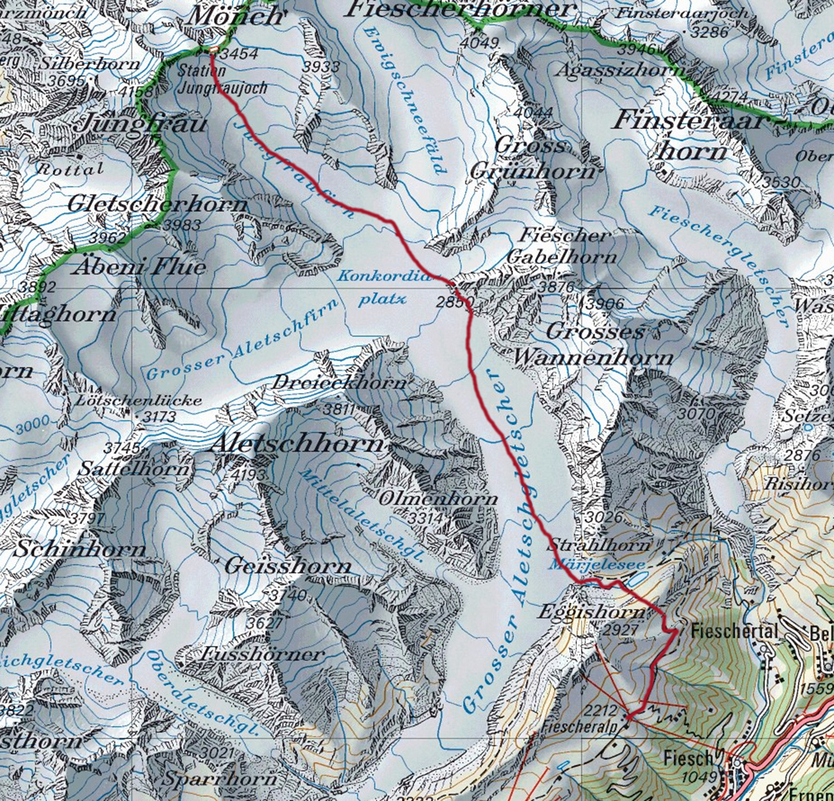
Below is the map of the Aletsch Glacier area.
This Swiss web site provides topographic maps of the whole country at various scale levels with an amazing quality, and all this for free. The print to pdf option is also nicely done and a very useful feature to prepare for a hike.

The Altesch Glacier is certainly one of those. No word can manage to translate the experience, what it feels like to witness this unique landscape and spend the night at the Konkordia Hut at 2850 meters of altitude.
For a total glacier virgin like I was, this trip was the perfect way to get a first impression of what hiking on a glacier was.
The Aletsch Glacier is the largest glacier in the Alps, with a length of 23 kilometers (14 miles).
The typical trademark of this glacier is the set of two medial moraines, which are the result of three smaller glaciers converging at the Konkordiaplatz, where the ice sheet is said to be 900 meters thick.
The three glaciers are the Aletschfirn, the Jungfraufirn and the Ewigschneefäld.
Another fourth glacier converges at the Konkordiaplatz, the Grüneggfirn, but being a much smaller glacier, its flow is dwarfed and obliterated but the sheer flow of ice coming from the Ewigschneefäld.
Grindelwald Sports in Grindelwald is the place to go to organize such a trip. The very friendly and welcoming team was extremely helpful in providing prompt and accurate information and advice based on personal experience and wishes.
They have many options in the Jungfrau region, ranging from regular trips like the Aletsch Glacier hike planned several times a month, to booking your own mountain guide and go anywhere you wish for as long as you wish, any time of year.
I recommend contacting them in case such adventure is on your mind
Grindelwald SPORTS AG
Dorfstrasse 110
3818 Grindelwald
Tel +41 (0)33 854 12 80
Fax +41 (0)33 854 12 95
Email: info@grindelwaldsports.ch
www.grindelwaldsports.ch
www.facebook.com/grindelwaldsports
At the time, the price was 325CHF per person for the hike only. They also have a price including the train ticket from Interlaken to the Jungfraujog, and back from Fiescheralp to Interlaken.
The price includes the hike with a mountain guide, the crampons & harness, the food at the Konkordia Hut for the evening dinner and breakfast, and of course the night at the hut.
Anyone can sign up and join an existing group of hikers.
In case one wants to hire a private mountain guide and hike or climb to a different place, or do this same hike but at some other time not joining an existing group, this is of course doable year round at a higher price.
The idea is that a mountain guide charges a fee per day, and the cost is divided by the number of people in the group.
The trip can be canceled at the last minute due to bad weather. Some might travel from far away and would have to factor in this possibility.
That's what actually happened the weekend before. The trip got then rescheduled during the week on the following Tuesday and Wednesday.
The week option seems to have been better because that night we were 70 people staying over at the Konkordia Hut. Hikers and mountaineers converge there because of the many possible hike options around the Konkordia.
Over the following weekend, the hut was supposed to be packed with 140 people, running at its maximum capacity.
We met with the mountain guide and the rest of the group at the Jungfraujog around 10:30 in the morning.
Our guide was Werner Fischer. He had 47 years of experience and has been a mountain guide like his father and grand father before him.
After a short briefing outside the Jungfroujog on the glacier, the seven of us including the guide set out for Konkordia Hut where we would spend the first night.


Climbers going up the Jungfrau
The human silhouettes provide a sense of the scale
The human silhouettes provide a sense of the scale

On the way up to the
Jungfrau South Face
Jungfrau South Face

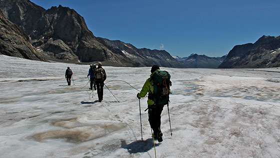
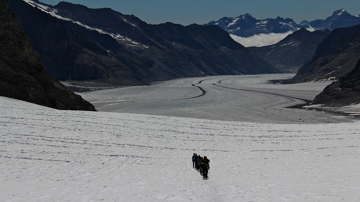
Hiking down the Jungfraufirn
towards Konkordiaplatz
towards Konkordiaplatz

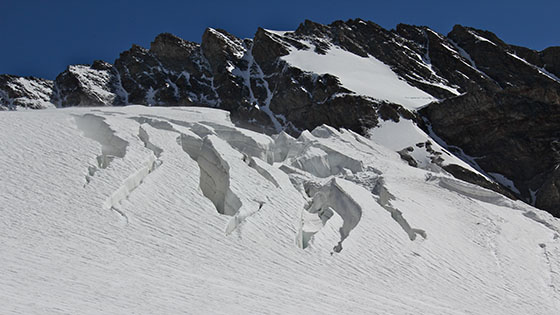
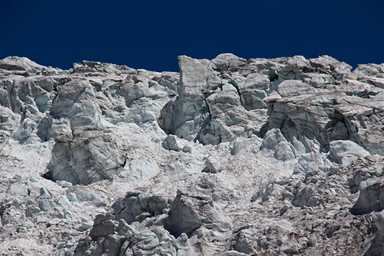
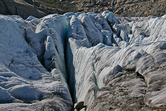
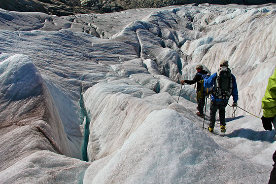
The first crevasses appear in the distance


one of the three main Aletsch Glacier's affluents")
Ewigschneefäld (Eternal snow field)
one of the three main Aletsch Glacier's affluents
one of the three main Aletsch Glacier's affluents


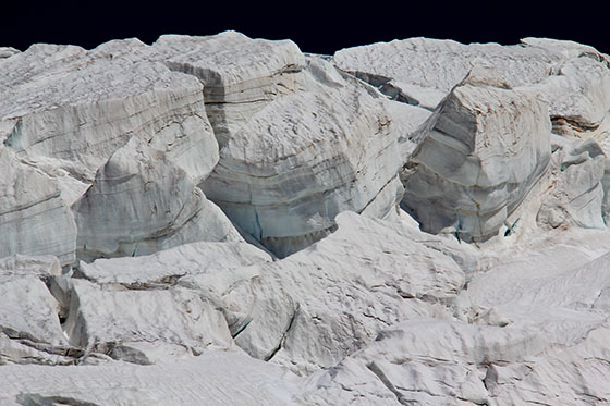
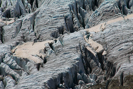
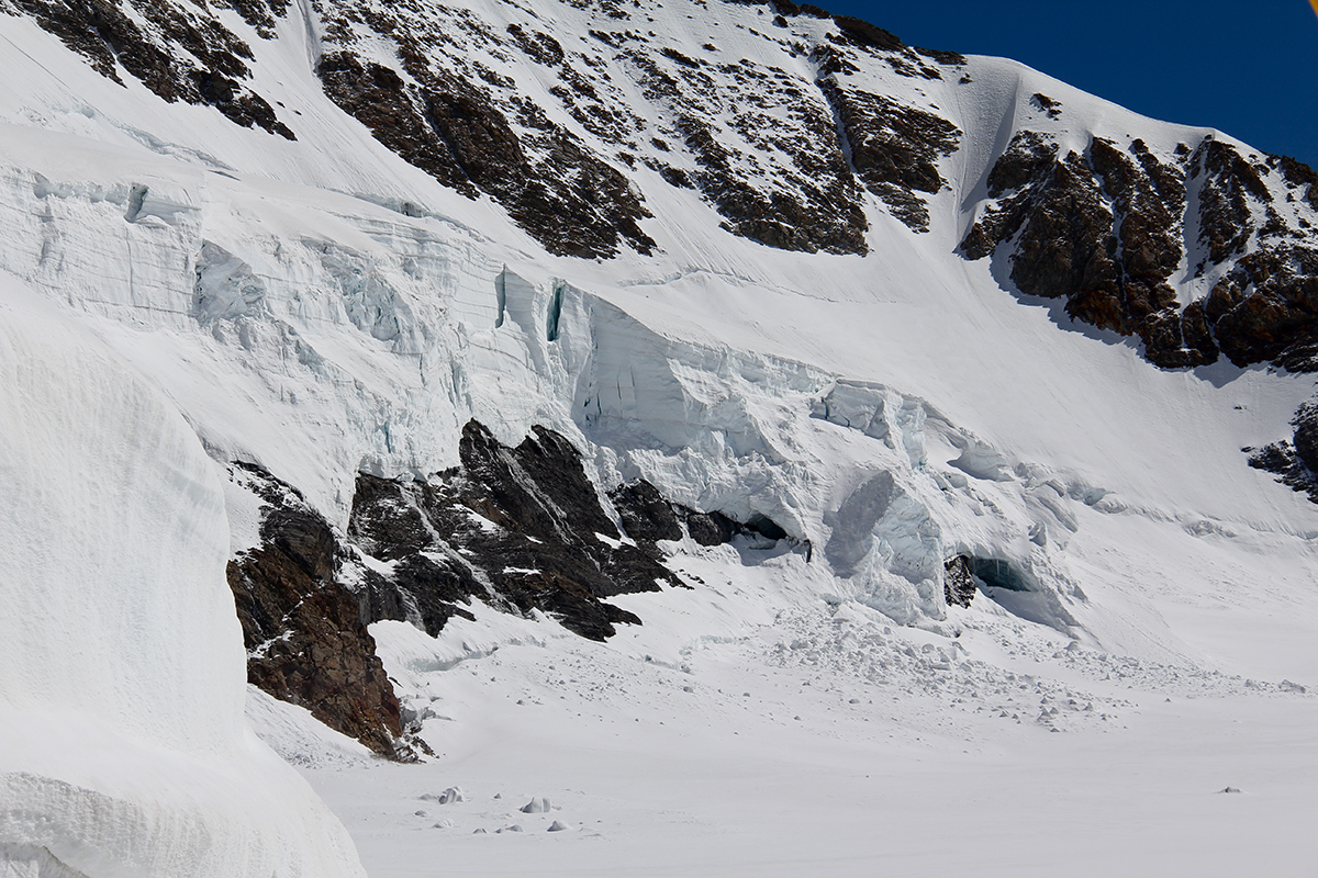
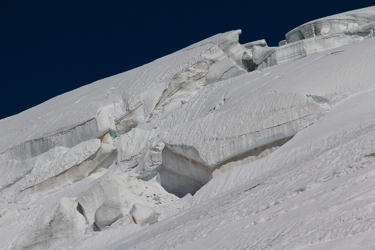
Wall of broken ice viewed from
the bottom of the Ewigschneefäld
the bottom of the Ewigschneefäld

and the Alteschhorn at 4193 meters of altitude")
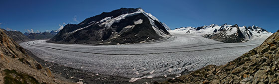
First look at the Great Aletschfirn
(Grosser Aletschfirn)
and the Alteschhorn at 4193 meters of altitude
(Grosser Aletschfirn)
and the Alteschhorn at 4193 meters of altitude
Viewed from afar, the dark medial moraine looks like a combination of sand and loose gravel. Up close, those gravels are actually massive blocks of rocks as it can be seen on the picture below.

Lunch break on the Trugbergmoräne
the easternmost moraine where
the Jungfraufirn and the Ewigschneefäld converge
the easternmost moraine where
the Jungfraufirn and the Ewigschneefäld converge
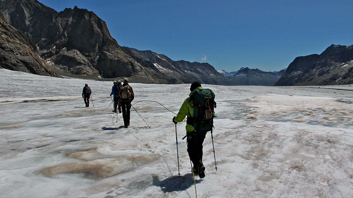

A large stream of water runs down the glacier.

Werner Fischer jumping across the stream
Jumping is the way to cross it
like we did it for several crevasses
Jumping is the way to cross it
like we did it for several crevasses
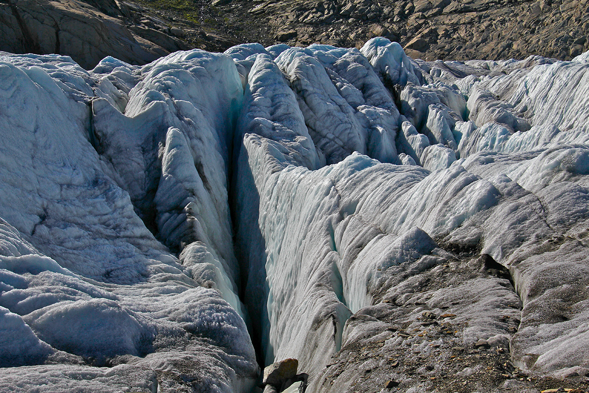
On the other side of the glacier we leave the sedimentary rocks found at the Jungfrau and reach a different geological layer made of granite, more solid, which creates a different landscape as it erodes differently and breaks down into blocks of different shapes. The glacier has lost 100 meters in thickness since 1877 when the original hut was built. There is a steel staircase to climb up the 150 meters separating the hut from the glacier.
Since 1960 the glacier has shrunk so much that the steel staircase has been expanded to reach the moraine.
")
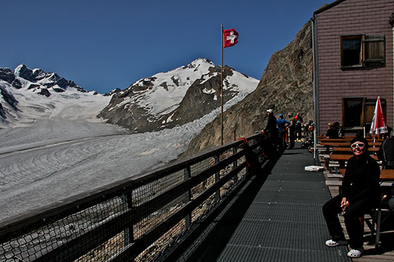
Arriving at the Konkordia Hut (Konkordiahütte)


We arrived at the Konkordia Hut around 14:00, and had the whole afternoon to sit down and enjoy the breathtaking view, while enjoying a few drinks from the bar.

The Jungfrau South Face
We can see the climbers' tracks left behind in the snow
We can see the climbers' tracks left behind in the snow

The Great Aletschfirn and the Hollandia Hut in the far background
The three human silhouettes give the scale of the debris
on the Kranzbergmoräne, the westernmost medial moraine
The three human silhouettes give the scale of the debris
on the Kranzbergmoräne, the westernmost medial moraine

Later on, the three hikers closing in on the Kranzbergmoräne

Pedicularis kerneri
found around the Konkordia Hut
found around the Konkordia Hut

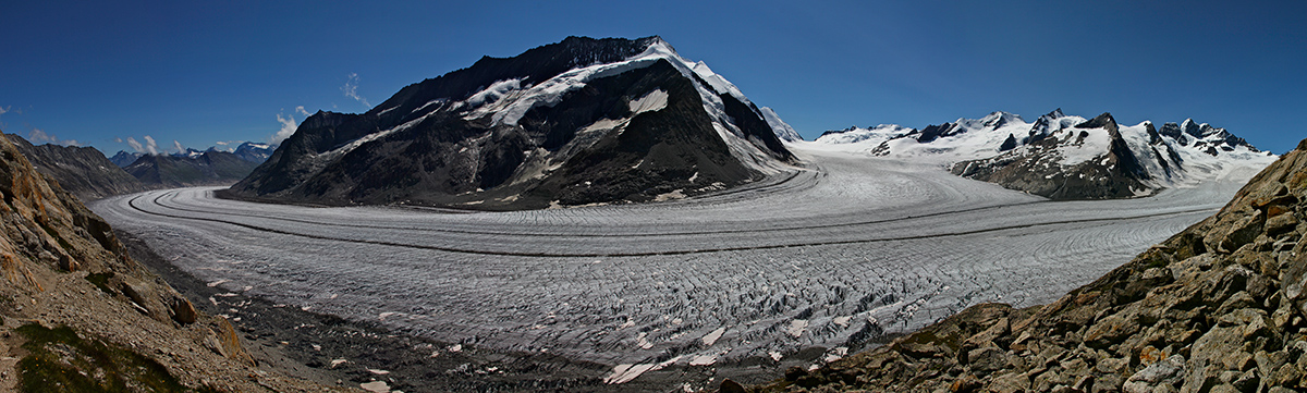
A larger panorama, made of 12 vertical shots
Later in the day, after a hearty meal, we could hear conversations such as:
- What time is breakfast tomorrow morning?
- Anytime starting from 3:30
- Oh good, perfect!
For a first timer like I was, I found the situation amuzing.
The next morning we were supposed to wake up at 4:30, have breakfast a 5:00 and be gone by 5:30. For some reason I woke up naturally at 4:15 and ran outside to enjoy the very first glimmer of dawn, only to realize that some had woken up way earlier and were already crossing the Konkordiaplatz with their headlights on.
Others can be seen in the distance on their way up to the Jungfrau. The partial moon helped photographing the scene.

Not much grass to eat for the chamois
Maybe the salt or other minerals hidden in the ground
Maybe the salt or other minerals hidden in the ground
The water streams at the surface of the glacier usually end up in a large hole like the one below, which likely drops to the bottom of the glacier bed. Impossible to lean over and see the bottom of this massive hole without getting into some serious trouble.

One of the smallest crevasses we encountered.
I was too busy watching my steps to be able
to grab a photo of a large one
I was too busy watching my steps to be able
to grab a photo of a large one

The Matterhorn in the distance
Il Cervino in Italian or Cervin in French
Il Cervino in Italian or Cervin in French

About to cross the Trugbergmoräne on the way out

Looking for a way out of this maze


Finally leaving the glacier
")
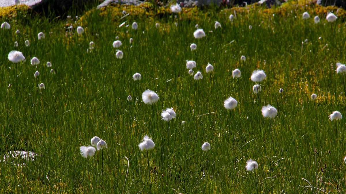
Eriophorum
(Cottongrass, Cotton grass or Cottonsedge)
(Cottongrass, Cotton grass or Cottonsedge)

Eriophorum bordering a small pond close to
Märjelesee
Märjelesee
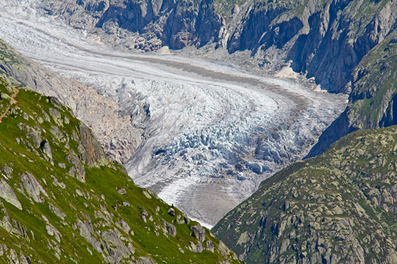
After a stop at the Gletscherstube Hut for a drink, and after crossing the tunnel, the Gletscherstube, I thought the show was over, but to my greatest surprise, on the other side we discovered a beautiful valley and in the distance another magnificent glacier, the Fiescher Glacier (Fieschergletscher).
")
The Fiescher Glacier (Fieschergletscher)

We then only had to hike down to Fiesheralp, pause for lunch and catch a gondola down to Fiesch in the valley where we could catch a train back to where we came from.
Below is the map of the Aletsch Glacier area.
This Swiss web site provides topographic maps of the whole country at various scale levels with an amazing quality, and all this for free. The print to pdf option is also nicely done and a very useful feature to prepare for a hike.